Showing posts with label Trainning. Show all posts

Monday, 15 April 2013

Wet day in Gwydir Forrest 14th of April,2013


Another Sunday on the bike.. and after the Snow trauma of last weekend  we were keen to avoid any suggestion, hint or light dusting of snow as well as looking not to require any bike-hiking.

After looking carefully over the maps that I've downloaded through  Viewranger for the Coast to Coast trip I drew together a route for the day. Meeting Carwyn at the car park nearby the forest, we got started on our journey.. Before i go further.. I have to mention the fact that it was raining a lot on this ride.. and by a lot.. i mean on a biblical scale! But as the word training suggests.. we had to get on with it. 

Despite the incessant rain, we had a fairly good ride.. we passed a bridge that had seen better days.. as well as a sign located nearby from the bridge owner i assume.. who by the sounds of it.. is a little unhappy that no one's taken an interest in hir bridge...


The ride continued well.. with long climbs and lots more depressing rain. Somewhere above 'Ty Hull' near Capel Curig, Carwyns chain broke.. as you can see on the picture opposite. Back in the day.. this would've meant a phone call to a parent to come and fetch you.. But not so in these modern times. 

Luckily, Carwyn had while in the bike shop on Friday invested in some spare chain links... a wise investment indeed as they were put to good use, along with some elbow grease to put the chain back together again. Feeling supremely awesome at our trailside surgery skills and still soaked from the rain.. we soldiered on. 

The rest of the ride passed relatively un remarkably.. I wont spend too much time talking about the unhappy farmer who wasn't to pleased to see us not walking down a nearby footpath through his farm.. but we managed to talk our way out of the situation. 

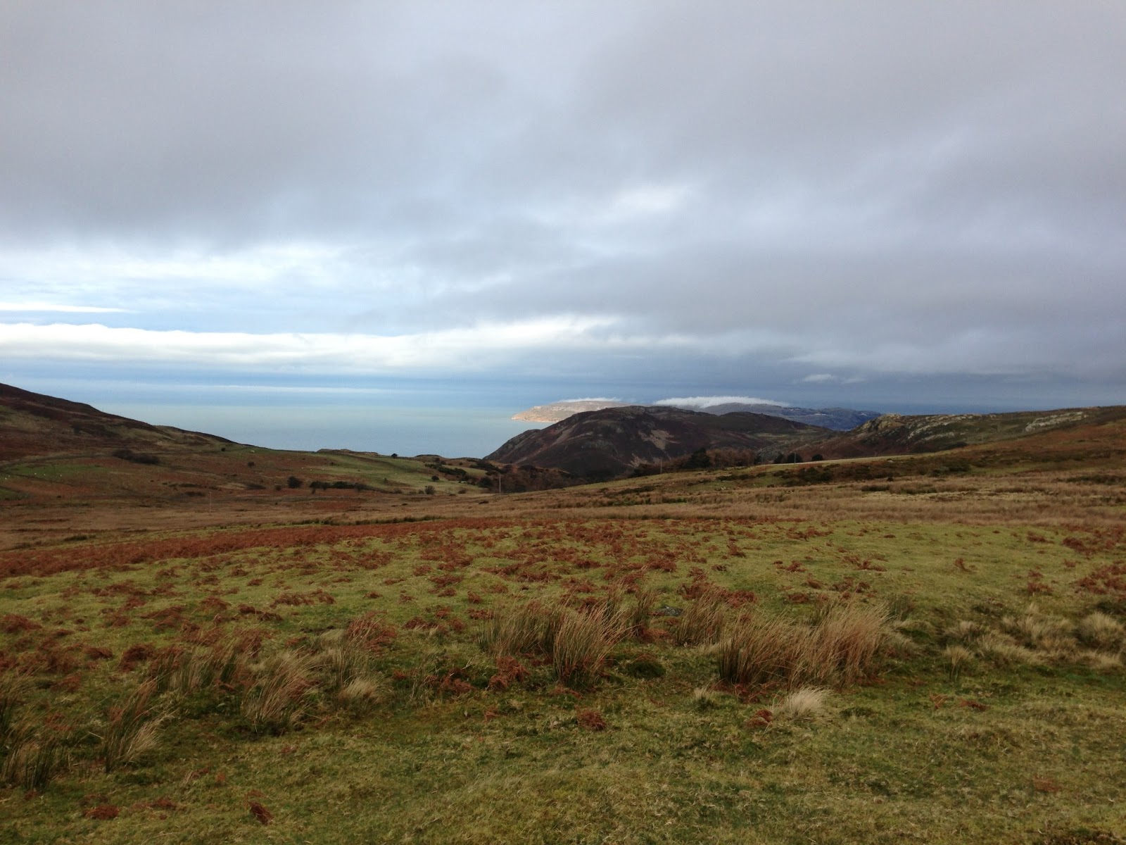
By the end of the day..the rain stopped chucking it down, the clouds parted to reveal some nice views of the Conwy valley for us to admire. Here's a few pictures and details of the ride for you below :- 


Monday, 8 April 2013

Snowy Circular above Coed y Brenin 7th of April


After discussing the Coast to Coast with Carwyn and some of his research, he suggested we should go on a ride similar to that we'll be facing on the trip itself. With this in mind, Carwyn made a gpx circular route starting from Coed y Brenin but avoiding the mormal tracks established in the centre and going up into the mountains and country allong fire roads, tracks and bridleways for 30 miles

Here's a few photos from early in the trip.
LLun gan Carwyn - Picture from Carwyn

The start of the trip went very well, we kept a good pace and we were getting used to navigating with our gps devices. Cawryn was using his Garmin and I was using my iphone with the Viewranger app. I'm planning on writing on the blog about the GPS app that I'm hoping to use for the Coast to Coast. 


We came accross some snow early on and here's a video of me having a go at riding through it. I think ill need some better tyres in this instance I think! 


After some more riding, we came across our first snow drift. You can see how deep the snow was after almost burying a nearby gate and swallowed my legs as you can see below :- 


After some lunch.. we set off and quickly reached a path that was covered in snow. Believing that the snow wouldn't be too bad, we set off up the snow as the path would later join a forest which we believed would be clear. What a mistake this was! After slogging for over an hour to get to the head of the path, where it crossed a stream to the forest, with the snow up to our knees for most of the way.. there was as much snow in the forest as there was outside it! As you can see from the pictures below.. the snow was thick enough to stand the bikes in! 

Snow standing bikes 


By now, we'd lost feeling in our feet, low energy and even less patience so we agreed to turn around to find another way. Once back down from the snowy path, the route went well.. loosing about 10 miles from the original path, but it turned out to be a good day where we learned a lot about navigation and reading the environment. One things for certain.. we'll be back when the snow's left!

Here's the details of the route:- 

Sunday, 13 January 2013

100 Byrgyrs wedi llosgi - 100 Burgers Burned


Endonmondo tracks and keeps all of my biking statistics. I've been tracking my riding since March 2012 and in addition to being a useful tool to help trainning, Endonmondo aslo keeps some entertaining statistics. Theses statistics include how many times I've riden around the world, ridden to the Moon and last but not least, How many Burgers I've burned.. and because of the ride yesterday.. I've AT LAST burned over 100 burgers.. only the rest of all the burgers I've eaten to go!! Here's the summary of the statistics below :-


Ma Endonmondo yn cadw crynodeb o ystadegau o'n beicio i gyd. Dwi di  tracio’n beicio ers mis Mawrth 2012 ac yn ogystal ai ddefnydd fel teclyn i helpu hyfforddi, mae Endonmondo hefyd yn  cadw ystadegau digri fel faint o weithiau dwi wedi bod o gwmpas y byd, faint o weithia dwi wedi bod i'r lleuad a faint o byrgyrs dwi wedi llosgi.. ac ar ôl y trip beicio ddoe.. HWRE O’R DIWEDD dwi wedi llosgi dros 100 byrgyr.. dim ond y gweddill o'r byrgyrs dwi di byta ar ôl i losgi! Dyma grynodeb o'r ystadegau isod :-


Bwystfil Penllyn Beast


Carwyn and I went for a ride around Penllyn yesterday. Carwyn had prepared a route on his new GPS unit. It was a longer trip than he usually does which only made it about 54 miles!!  As it was so long.. and as Carwyn managed to find all of the hills and mountains in the area for us to ride.. I'm going to christen this route as the 'Beast of Penllyn'.

This is my longest ride to date..and its good training for the Coast to Coast challenge. Few more of these and  I'll be in good shape for the trip.. i was knackered by the end of the day! Having said that.. the trip was great with some fantastic views. I've put included some photos below.


Aeth fi a Carwyn am reid o gwmpas Penllyn ddoe. Roedd Carwyn wedi paratoi siwrna ar ei declyn GPS newydd.. fersiwn hirach na'r trip arferol mae'n dilyn dim ond 54 milltir !!! Gan ei fod mor hir.. a gan fod Carwyn wedi llwyddo i ffeindio bob  allt a mynydd yn yr ardal dwi am enwi'r trip yma 'Bwystfil Pen Llyn'

Hwn ydi'r reid hiraf dwi di fod ar feic erioed.. ond mae'n trainning da ar gyfer yr her o’n blaenau efo'r Coast to Coast. Chydig mwy o rain a fyddai mewn siâp da  i'r siwrna.. o’n ni'n nacyrd erbyn i mi gael adra fyd. Roedd y llwybr yn grêt a'r golygfeydd yn fantastic.. Dwi di gosod chydig o lunia isod.

Fi gyda Nefyn yn y Cefndir - Me with Nefyn in the background
Carwyn sydd hefyd isio mynd o'r Top i'r Gwaelod efo nefyn yn y cefn
Carwyn a C2C Contender also with Nefyn in the back


Ynys Enlli - Bardsey Island


Flapjack for Carwyn's Flapjack
Frwyth Sych i gadw fi fynd
 Some Dried Fruit to keep me going


Traeth Aberdaron - Aberdaron Beach


Saturday, 5 January 2013

Manylion y reid - Details of the ride


Dyma fanylion y reid dwytha efo Carwyn. Here's details of the last ride with Carwyn.


Dechra dod i ddallt y busnes blogio ma..starting to get to grips with blogging i think.


Friday, 4 January 2013

Reid Gyntaf y Flwyddyn - First Ride of the Year

Mi aeth Carwyn a finnau ar y reid gyntaf y flwyddyn heddiw, er mwyn dechra paratoi i 'O'r Top i'r Gwaelod'
Yn benderfynol o ddilyn llwybr naturiol .. h.y. ddim mewn canolfan beicio, mi aethom ni ar y trên o Fangor i Gyffordd Llandudno a beicio i Gonwy er mwyn dilyn Llwybr y Gogledd yr holl ffordd i Abergwyngergyn. Dyma linc i fanylion am y llwybr.  North Wales Path


Mi aeth pethe’n dda A drwg ar y reid.. y pethau da oedd bod yr iphone5 yn eithaf da fel GPS tracker wrth ddefnyddio app sy'n dangos OSmaps. Roedd y top gwlân Merino hefyd yn dda gan ei fod wedi cadw fi'n gynnas o’n ddim yn boeth. Y pethau drwg oedd bod hydration pack fi yn dechrau gollwng dros fy nghefn a fy nhin, ma angen sgidia beicio call arnai a dwi angen gwella ffitrwydd... ond dydi hynna ddim yn sioc fawr!

Dyma'r llwybr fel cafodd ei recordio gan Endonmondo a chydig o luniau i ddilyn :-


Carwyn and I went on the first ride of the year today to begin training for the Coast to Coast. Determined to have a go on more natural paths i.e. not on trail centres, we caught the train to Bangor to Llandudno Junction, rode to Conwy to catch the North Wales Path all the way back to Abergwyngregyn. Here's a link to information on the path.  North Wales Path

Parts of the ride went well.. others didn't  Of the things that went well, the iphone 5 is a pretty good GPS tracker when using the appropriate OSMapping apps. The new Merino wool top was warm but not too hot. Things that didn't go to well included my hydration pack leaking all over my back and bum ! I also need some sensible shoes to go biking on and improve my fitness.. but then that's not a surprise!

Here's a track of the ride recorded by Endonmondo  and some photos to follow :-
                         
                                       
Edyrch yn ol am yr Orme View back towards the Orme

Carwyn yn edych yn hapus - Carwyn looking happy

Mwd mwd mwd - Mud Mud Mud

Ceffyl gyda Ynys Seiriol yn y cefndir - Horse with Puffin Island in the back


Golygfa lawr am Llanfairfechan - View towards Llanfairfechan


Carwyn wedi ffeindio wbath neis - Carwyn just found something nice

Panorama o fi - panorama with me in it